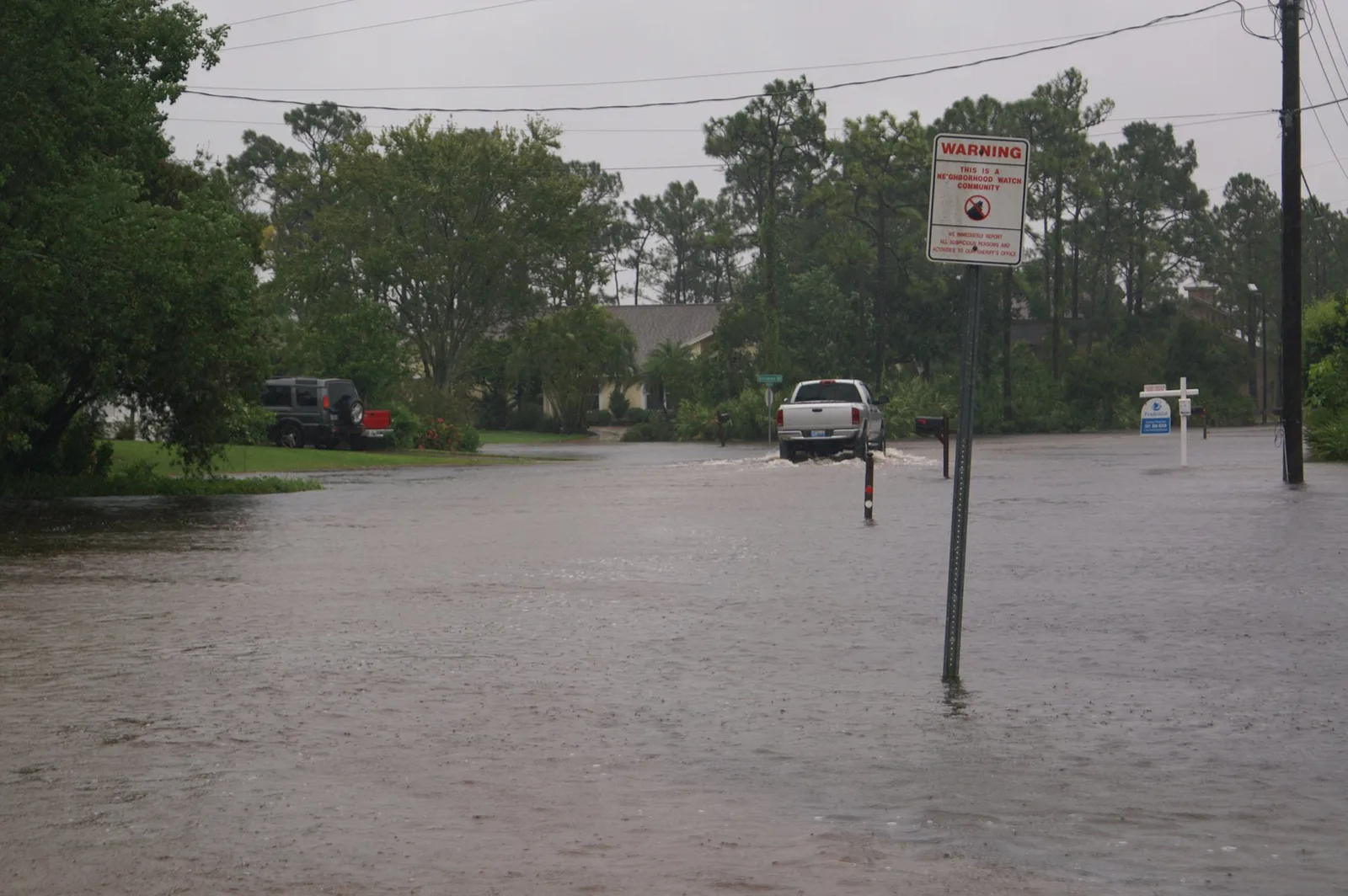
Up to 8.38 inches of rain fell on central Bay County on Sunday, and cars were trapped on East 23rd Street and MLK. Where it flooded, and what to do now.
Up to 8.38 inches of rain fell on central Bay County on Sunday, flooding streets across Panama City and trapping cars in high water on at least two roads.
The National Weather Service in Tallahassee issued a string of flash flood warnings for central Bay County from before dawn until close to noon. One of them, at 8:15 a.m. CST, warned of “life threatening flash flooding.” The details below come from the warnings and from the weather service’s preliminary storm report summary for Sunday, Nov. 1.
It came less than a month after Isaias pushed Bay County tide gauges to flood stage.
How much rain fell
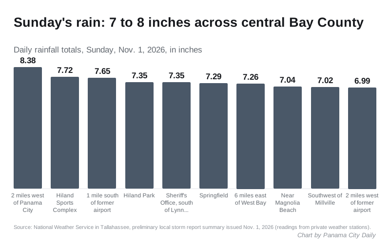
Ten private weather stations in central Bay County, whose readings the weather service passed on, each recorded close to 7 inches or more of rain on Sunday:
| Where the station is | Rain (inches) |
|---|---|
| About 2 miles west of Panama City | 8.38 |
| Hiland Sports Complex | 7.72 |
| About 1 mile south of the former Panama City-Bay County airport | 7.65 |
| Hiland Park | 7.35 |
| Bay County Sheriff’s Office, about 2 miles south of Lynn Haven | 7.35 |
| Springfield | 7.29 |
| About 6 miles east of West Bay | 7.26 |
| Near Magnolia Beach | 7.04 |
| Southwest of Millville | 7.02 |
| About 2 miles west of the former airport | 6.99 |
The weather service labels the report preliminary. Its warnings said radar showed 4 to 8 inches had fallen by mid-morning.
Where it flooded
Law enforcement reported these problems to the weather service on Sunday morning:
- the outside lane of eastbound U.S. 98 flooded
- the intersection of 14th Street and Beck Avenue flooded
- flooding on the 1200 block of Harrison Avenue
- lanes closed on 15th Street
- vehicles trapped in floodwater on East 23rd Street
- a car flooded near 14th Street and Mercedes Avenue
- vehicles trapped on MLK between 15th and 16th streets
- West 4th Street impassable
- barricades requested for 19th Street just east of Michigan Avenue
Outside the city, deputies asked for barricades at Lake Drive and U.S. 98 in Parker, about five miles southeast. A video posted online, which the weather service logged, showed water covering Westover Circle near 23rd Street and Beck Avenue.
No injuries were listed in the weather service report.
The warnings
The last warning named these places at risk: Panama City, Lynn Haven, Callaway, Springfield, Parker, Hiland Park, Dirego Park, Cedar Grove, Millville, Bay Harbor and Magnolia Beach.
- 5:53 a.m. CST: first flash flood warning for central Bay County, with 2 to 4 inches already down.
- 8:15 a.m.: a new warning said 5 to 8 inches had fallen and called the flooding life threatening.
- 9:41 a.m.: the last warning, in force until 11:45 a.m., said 4 to 8 inches had fallen and “flash flooding is already occurring.”
As of Thursday afternoon, the City of Panama City had not posted a statement about Sunday’s flooding on its news page.
What the city is doing about repeat flooding
Two city programs aim at streets and homes that flood again and again:
- A citywide stormwater master plan. The City Commission voted 5-0 on Oct. 13 to accept an $800,000 state-funded grant to write one, as we reported in our Downtown Marina story.
- Voluntary home buyouts. The city’s Voluntary Home Buyout Program buys homes damaged by Hurricane Sally in areas that flood repeatedly, at fair-market value. The land is kept as open space or for stormwater. The program is funded by a federal disaster recovery grant from the U.S. Department of Housing and Urban Development.
What it means for you
- Report a street that still floods or drains badly. Use the city’s Report a Concern page or call City Hall at 850-872-3000.
- Check your flood zone. Look up any address on the city’s flood data site. Our hurricane prep page explains why a flood zone and an evacuation zone are not the same thing.
- Never drive into water over the road. Just 12 inches of rushing water can carry away most cars, the weather service’s Turn Around Don’t Drown page says. The road underneath may have collapsed.
- If your car or home took water, photograph the damage before you clean up and call your insurer. Most homeowners insurance does not cover flood damage. Flood insurance is a separate policy, according to the National Flood Insurance Program’s FloodSmart site.
For current closures, see our Panama City road closures page.
Frequently asked questions
How much rain fell in Panama City on Sunday, Nov. 1?
Weather stations cited by the National Weather Service in Tallahassee recorded daily totals of about 7 to 8.38 inches across central Bay County. The highest was 8.38 inches, about 2 miles west of Panama City.
Which Panama City streets flooded on Nov. 1?
Law enforcement reported flooding to the weather service on eastbound U.S. 98, 14th Street at Beck Avenue and at Mercedes Avenue, the 1200 block of Harrison Avenue, 15th Street, East 23rd Street, MLK between 15th and 16th streets, West 4th Street and 19th Street east of Michigan Avenue.
How do I find out whether my Panama City home is in a flood zone?
The city’s flood data site at panamacityfl.withforerunner.com lets you look up a property’s flood zone.
Have your say