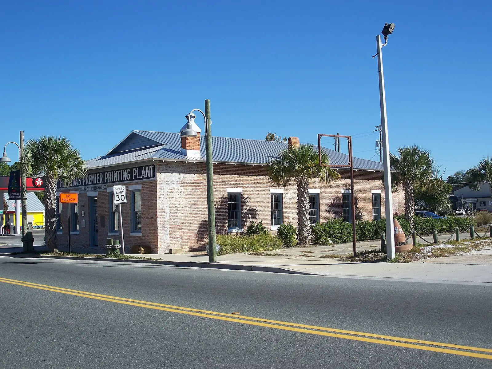
St. Andrews, a city redevelopment area since 1989, is in ZIP 32401, zoned for Jinks Middle and Bay High. Typical 32401 value: $217,221 in August 2026.
Last checked Oct. 10, 2026. Sources: the City of Panama City’s St. Andrews CRA page, golf cart neighborhoods announcement and map, Bay County’s school attendance zone maps, the Florida Department of Education’s 2026 school grades, Zillow Research and OpenStreetMap.
St. Andrews is the bayfront area west of downtown, centered on Beck Avenue and the St. Andrews marina. The city calls it “a village by the bay where cultural attractions, entertainment, and commerce thrive.” It mixes older homes on grid streets with shops, restaurants and the Saturday market.
What this means for you
- Zoned high school: Bay High, graded C in 2026.
- Home value: $217,221 in ZIP 32401 in August 2026, according to the Zillow Home Value Index.
- Main roads: Beck Avenue, Frankford Avenue and 15th Street (U.S. 98).
Part of our Panama City neighborhoods guide.
Where it is
The Panama City Commission made St. Andrews a Community Redevelopment Area in 1989, and in 1997 the state named it a Waterfronts Florida Partnership Community, according to the city’s St. Andrews CRA page. The Historic St. Andrews Waterfront Partnership runs the Panama City Publishing Company Museum and Visitor’s Center and The Market at St. Andrews.
On the city’s golf cart neighborhoods map, St. Andrews runs from Beck Avenue east toward Harrison Avenue, between 15th Street on the north and Beach Drive and the bay on the south. Lake Huntington lies to the west across Beck Avenue, and Forest Park to the north across 15th Street. OpenStreetMap marks the place “Saint Andrew” near Beck Avenue and 12th Street. The area is in ZIP code 32401.
Main roads, with route numbers from OpenStreetMap: Beck Avenue (Business U.S. 98 at its south end), West 10th Street (Business U.S. 98), West 11th Street (County Road 28), Frankford Avenue (County Road 385) and 15th Street (U.S. 98).
Schools
Bay County’s school attendance zone maps put all of St. Andrews in one middle and one high school zone, but split it among three elementary zones. Grades are from the state’s 2026 school grades:
| Level | Zoned school | Where in St. Andrews | 2026 grade | 2025 grade |
|---|---|---|---|---|
| Elementary | Lucille Moore Elementary, 1900 Michigan Ave. | West, near Beck Avenue | D | C |
| Elementary | Oscar Patterson Academy, 1025 Redwood Ave. | Middle blocks | D | B |
| Elementary | Merriam Cherry Street Elementary, 1125 Cherry St. | Southeast, toward downtown | C | B |
| Middle | Jinks Middle, 600 W. 11th St. | All | C | C |
| High | Bay High, 1200 Harrison Ave. | All | C | B |
The federal school directory lists Oscar Patterson Academy as pre-K through third grade, so ask Student Services (850-767-4328) where fourth and fifth graders in that zone attend. Check one address with the district’s School Zone and Bus Route search. Jinks Middle is inside St. Andrews. More in our schools guide.
Home values
The typical home value in ZIP 32401 was $217,221 in August 2026, up 1.3% from $214,538 a year earlier, according to the Zillow Home Value Index. It is a modeled typical value for the middle third of homes across the whole ZIP code, not a sale price, and 32401 also covers downtown, the Cove, Millville and Glenwood. The figure for Panama City as a whole was $284,369. See our home prices guide.
Parks and trails
- Oaks by the Bay Park, 2715 W. 10th St., at the south end of Beck Avenue. Five acres on the bay with a boardwalk, gazebo, pavilion and observation platform; home of the Saturday Market at St. Andrews.
- Truesdell Park, 2629 W. 10th St., with a playground.
- Oakland Terrace Park and Sports Complex, 1900 W. 11th St.: a walking track, playground, five pickleball courts, four tennis courts and five baseball and softball fields.
- Bay Memorial Walking Park, 810 Garden Club Drive: more than 13 acres with a lighted 1-mile track, fitness stations and disc golf.
- Al Helms Dog Park, 1022 Balboa Ave., dawn to dusk.
Details in our parks and trails guide.
Getting around
- Downtown: City Hall is about 2 miles east by road.
- Airport: Northwest Florida Beaches International Airport is about 27 miles by road. Both distances are measured on the OpenStreetMap road network; they are not drive times.
- Buses: Bayway lists routes 3 to 7; find the nearest stop with its trip planner or call 850-769-0557.
- Parking: the city’s St. Andrews parking map took effect Jan. 16, 2026, with posted time limits. See our getting around guide.
- Golf carts: allowed on designated streets since the City Commission adopted Ordinance No. 3233 on Aug. 13, 2024, but not on Beck Avenue, Frankford Avenue or 15th Street.
Groceries and everyday stores
OpenStreetMap lists a Piggly Wiggly at 1380 W. 15th St., on the area’s northern edge. A Publix (650 W. 23rd St.), a Walmart Supercenter (513 W. 23rd St.) and a CVS Pharmacy (955 W. 23rd St.) are north of the area on 23rd Street.
Nearby areas
Lake Huntington, Forest Park, Downtown and Downtown North.
Frequently asked questions
What ZIP code is St. Andrews in Panama City?
- Zillow put the typical home value in ZIP 32401 at $217,221 in August 2026, up 1.3% from a year earlier.
What schools is St. Andrews zoned for?
All of St. Andrews is zoned for Jinks Middle and Bay High, both graded C in 2026. The elementary zone is split between Lucille Moore Elementary, Oscar Patterson Academy and Merriam Cherry Street Elementary, so check the address.
Is St. Andrews a good place to live?
St. Andrews is a bayfront area west of downtown with Oaks by the Bay Park, Oakland Terrace Park and Bay Memorial Walking Park. It is in ZIP 32401, where the typical home value was $217,221 in August 2026, according to Zillow, and is zoned for Bay High, graded C in 2026.
Can you drive a golf cart in St. Andrews?
Yes, on designated streets. The City Commission added St. Andrews streets in August 2024 under Ordinance No. 3233. Golf carts cannot use or cross state or county roads such as Beck Avenue, Frankford Avenue or 15th Street.
Have your say